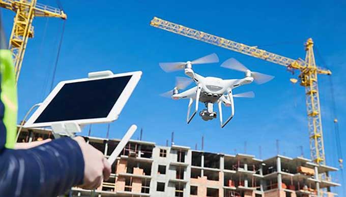
The Construction Industry and Drones: How are they going to benefit each other?

The benefits include increased efficiency, productivity, and accuracy on the job site. Earthmoving operations have become more versatile with the use of drones and the aerial eye. Moreover, drones provide a steady stream of job site progress data, which reduces unplanned costs and rework on a project.
Contractor Payment
It is crucial for contractors to prove their estimates accurately so they can be paid properly. Accurate measurement proof can lead to thousands of dollars in savings. Drone data allows you to reconcile estimates and payments without relying on subcontractors' measurements.
You may have to move more earth than planned, so contractors could miscalculate how long the project would take. It is also possible to avoid delays and penalties if you have highly accurate estimates.
Misaligned Construction Cost Prevention
Pre Construction: Drone data can save a lot of money during the initial planning phase.
You can save time and money by spotting mistakes before they happen with 3D elevation models during pre construction.
Execution: A few centimeters off plan can cause problems as construction progresses if any part of the structure is built. Backtracking and possibly demoing and rebuilding the project will cost time and money.
Bad Asset Management Cost: In the course of business, the value of proper maintenance may not appear obvious, but if a critical issue arises and it is caused by poor maintenance, it can be extremely costly for your organization. Dams, power plants, power lines or retention ponds with toxic waste are especially vulnerable to such damage, especially if they support human residence or transit.
High resolution drone images enable maintenance teams to inspect assets quickly, identify wear and damage, and prioritize operations. Crews who perform their work faster and more efficiently mitigate catastrophic failures that could have a negative impact on the environment and the economy.
Post Project Documentation: The majority of construction companies do not conduct a post project analysis. It just takes them time and money to figure out how much it will cost. This approach, however, does not provide the capability to optimize for future projects.
Data from drones and documentation of changes make it easy to verify what happened at a certain stage. In this way, better estimates can be made when bidding on similar projects, perhaps contributing to the success of the bid.
Point Cloud
Drone images can be used to create a densify point cloud. There is geospatial and color information associated with each point. An earthmoving vehicle can move concrete from one location to another using this model to measure distance, area, and volume.
3D Model from Raw Images
In 3D textured meshes, the edges, faces, vertices, and textures of the aerial images are reproduced. If external stakeholder input or public involvement is critical to a project, this model is useful for visual inspection. When raw images are used for inspection and analysis of assets, they provide more detail since they have not been processed.
Demerits of Drones in Earthmoving
Government Regulations: Regulations regarding drone flight and restrictions around urban areas and certain airspace differ from country to country. If there is an accident, there is less risk to people and valuable property on a highway in the middle of nowhere than on a densely populated site.
Regulations often change rapidly to meet the needs of modern and future commercial uses. You must ensure that your staff is trained and regularly updated to remain compliant with regulations and operate drones safely as a construction company if you wish to internalize this capability.
Maintenance Issue: Training staff to operate, manage, and maintain a drone is one of the first problems when investing in drones. In order to obtain accurate information from images, some drones require piloting skills and others geospatial experts.
You need to ensure that your team can get the information they need at the end of the process by considering how the drone fits into your workflow. A drone with well integrated sensors and positioning systems is ideal, as is software that is easy to use. Organize your staff on site so that they can use them independently whenever they need them and get accurate data from them.
Proper Training Experience: It may be beneficial for some contractors to partner with a subcontractor specializing in drone services.
Specialists like these have the authorizations, the pilots' training, and the knowledge to process the data and get the desired insights. They can also abide by the country & the local regulations governing airspace usage.
To learn more, watch the following video tutorial.
Video Source: Geospatial World
Organizational Value: You need to internalize drone insights once you have proven their value to your organization. Drones can be used internally instead of by service providers for many reasons. First, the data could be sensitive and you may wish to have your own team handle it.
Depending on the type of service, you might not want to ask the provider to visit the site a week in advance and then wait for the results. It might be necessary to have the data at hand right now to make a decision. This results in you being able to get the data on a weekly basis, rather than just once a month.