GIS in Civil Engineering: Explained

What is the meaning of GIS in the field of Construction?
GIS stands for Geographic Information System, which is used for acquiring, storing, manipulating, analyzing, managing, and communicating digital geographic data. A database of digital information containing these data is connected to thematic maps and can cover many fields of study.
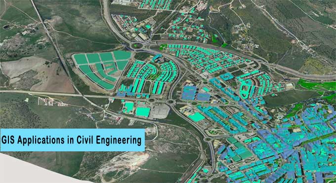
In a typical GIS interface, for example, multiple layers of spatial data are displayed on a digital map that enables users to examine and analyze patterns and nongraphical data with a level of accuracy and clarity that would otherwise be impossible.
In order to make a GIS map you are required to use tools such as BIM-GIS software which allows you to geolocate BIM information models on the GIS maps and then it is used to create informative databases with ease.
Data pertaining to a particular place can be analyzed and viewed using GIS in construction. GIS interfaces can be composed of any type of information associated with maps, such as addresses or geographic coordinates. Among GIS thematic maps are those that provide socioeconomic data about a neighbourhood, and ecosystems in an area, for example, before a new highway project begins, traffic studies, weather events, seismic data, etc.
A safe, secure, accessible, anytime and anywhere digital container encapsulates all of this information.
What role does GIS play in Construction?
The survey of an intervention area is typically the first step in the definition of a new construction project.
CAD, BIM (Building Information Modelling), and GIS software are able to process highly accurate data using today's surveying tools such as stations, drones, laser scanners, etc.
As GIS becomes increasingly integrated with BIM in the construction industry, this represents a significant step forward for civil engineering as well, especially for the design and management of infrastructure.
BIM and GIS tools are increasingly exchanging digital information as BIM usage increases. In design and construction, BIM can utilize GIS data acquired from initial site surveys. A digital as-built survey of a completed building provides accurate information about geometric information, material types, project phases, costs, energy consumption, numbers of users, etc. This information flows into a single digital container that everyone can access anytime, anywhere, in a safe way.
How does GIS apply to Civil Engineering?
The field of civil engineering spans a wide range of interests and specialities, including those related to the creation and upkeep of infrastructure. Systems for collecting and interpreting the information gathered are essential since a substantial volume of data from a wide range of sources is used.
By providing tools for creating, managing, analyzing, and visualizing data related to infrastructure development and management, GIS supports civil engineering. Practically, it allows data to be managed, allowing for easy understanding, analyzing, and sharing between stakeholders.
The use of GIS in civil engineering spans a number of fields, including:
1. Environmental - In order to conduct environmental impact assessments and analyses, engineers need accurate information on terrain, water sources, and other natural features provided by GIS. Data are brought into the analysis maps so that less impactful solutions and natural disaster predictions can be made.
2. Transport - In the field of transportation engineering, GIS enables the overlay of enormous amounts of data that are also very dynamic.
3. Analysis of Construction Site - In order to immediately provide a clear and comprehensive picture of the place of interest, GIS analyses and combines a range of pictures and data by constructing an overlay of pertinent data on economic activity, transportation flow, and population increase, etc.
4. Integration with BIM - Using BIM and GIS in combination allows data to be exchanged without losing information, allowing queries within a single database to be performed. With a data-centric approach, you can gain a more detailed understanding of the work and the urban and natural context, which enables informed decision-making, greater stakeholder involvement, and faster processes. GIS data enriches BIM models with information, while BIM provides information to GIS systems.
How does GIS benefit Civil Engineering?
The benefits of using geographic information system (GIS) in civil engineering include:
To learn more, watch the following video tutorial.
Video Source: Ekeeda
1. Improved decision-making: It becomes easier and more informed to make decisions when specific and detailed information is presented.
2. Resource optimization: Well-planned, analyzed, and shared processes lead to cost reduction and increased efficiency;
3. Easily accessible database: All authorized users have easy access to data on a database, regardless of their location or time.
4. Improved Communication: GIS helps in the proper organizing of information and data, The process is made clear and communication and interoperability among experts like technicians, contractors, public administration, etc and is facilitated by structuring information so that it can be readily accessed.